The UK’s Met Office national weather forecaster on Friday said the developing El Nino weather pattern was likely to be the strongest in living memory.
El Nino is declared when sea temperatures in the tropical eastern Pacific rise 0.5 degrees above the long-term average, impacting global rainfall patterns and average temperatures.
The natural warming of sea temperatures is forecast to reach more than 3 degrees in the coming months, making this year’s weather event “the largest since the 19th century”, according to the Met Office.
It creates a heightened risk of drought in the tropics, southern Africa and northeast Australia, while north-western Europe is likely to experience wetter and stormier conditions in the coming autumn and early winter, the forecaster said.
RM Block


“We should be clear that this is an unprecedented event”, Prof Adam Scaife, head of long range forecasting at the Met Office, said.
“I have never seen an El Nino signal this intense in our forecasts.”
He added: “A typical El Nino leads to an equatorial Pacific sea-surface temperature rise of between one to 2 degrees, with 2 degrees being a really big event.
“This implies that if the forecast is accurate – and other forecast systems show similar extreme values – then 2026 will far exceed our recent experience of El Nino and its worldwide climate influences.”
El Nino events also drive an increase in global average temperature, with 2027 forecast to be the warmest year on record.
“During large El Nino events significantly more heat is released from the ocean to the atmosphere leading to an increase in global average temperature, particularly in the calendar year following the winter peak of the El Nino,” Met Office science fellow, Nick Dunstone said.
“Hence, 2027 is very likely to replace 2024 as the warmest year on record and be another year to temporarily exceed plus 1.5 degrees above the pre-industrial period”.
Prof Stephen Belcher, the Met Office’s chief of science and technology, said: “This summer we have experienced heatwaves across Europe reminding us of the effects of climate change, this large El Nino is a reminder that natural variations in the climate system are also at play, adding to the stresses of climate change.”
[ Ireland’s warming seas pose risk to public health, scientists warnOpens in new window ]
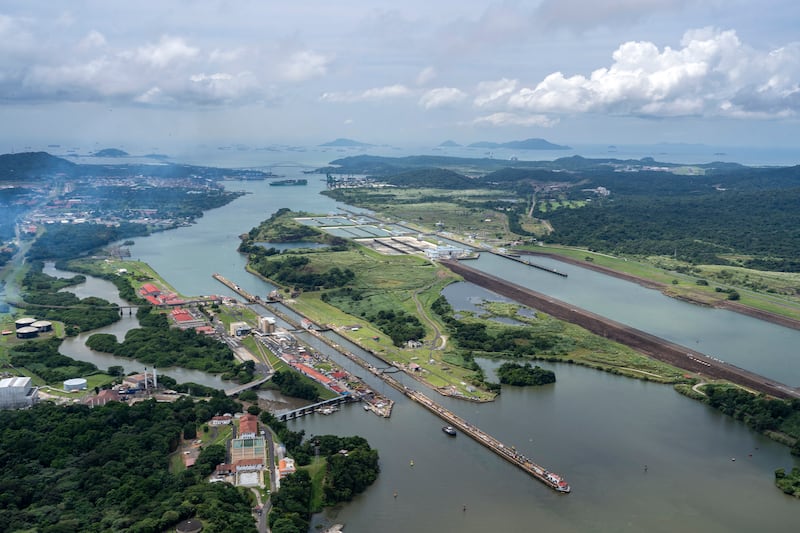
The Panama Canal Authority said on Thursday that it will cap daily passages as of early September as it gears up for a longer-than-usual El Nino season expected to reduce water levels, reversing a previous pledge to not limit vessel passage.
Under the new measures, the canal will limit daily transits as of September 4th to 34 vessels, and reduce the number to 32 as of September 15th.
The canal had registered an average of 35 daily transits through June 2026, corresponding to vessel demand, with the capacity to handle around 40 crossings per day.
In May, canal authorities told Reuters that the waterway was not planning vessel passage restrictions this year, and had already been taking water conservation measures since 2025.
The canal authority also disclosed that rainfall from May to August was 34 per cent below the historical average, while watershed inflows were 44 per cent below normal levels.
It warned the anticipated severity of the 2026-2027 El Nino event could further reduce precipitation, threatening the long-term sustainability of the waterway and local water supplies. – Reuters
[ Met Éireann forecasts mostly dry and bright weekend after week of showersOpens in new window ]